Heritage and History · Walking and Trails · North Norfolk, UK
The Peddars Way is a 46-mile (74km) National Trail following an ancient Roman military road from Knettishall Heath near Thetford (Suffolk border) to Holme-next-the-Sea on the North Norfolk coast, UK. Most walkers take 4 to 5 days. Terrain is easy to moderate: wide tracks, gentle gradients, excellent waymarking. Best North Norfolk base for the finish: mYminiBreak Holme-next-the-Sea.
- Distance: 46 miles (74km) one way
- Days: 4 to 5 (fit walkers can push 3)
- Start: Knettishall Heath Country Park
- Finish: Holme-next-the-Sea
- Dogs / bikes: Dogs welcome; most of the route open to cyclists

Most long walks bend with rivers and ridges. The Peddars Way does not. It runs arrow-straight across Norfolk, UK because it began as a Roman military road, almost certainly after Boudica’s Iceni revolt in AD 60 to 61. Legions needed speed through subdued territory. Straight roads are military roads. Under that engineering sits something older still: a pre-Roman trackway that Bronze Age and Iceni travellers may already have used. You are walking a corridor that could be 3,000 years deep.
The medieval name Peddars comes from pedlar traffic. After Rome left, salt, fish, wool and grain still moved along the same line. It has never truly gone quiet.
Holme’s three layers: Finish at Holme-next-the-Sea and you stand on Viking-named ground (holmr means dry rise from marsh), beside a Bronze Age sacred shore (Seahenge, 2049 BC), on a Roman road terminus. That is the story the trail hands you at the sea.

The four stages (either direction)
Official tradition is south to north: Knettishall to Holme, finishing with the sea on the horizon. Many walkers reverse it and start at the coast. Distances below run coast-first from Holme inland; flip them if you walk the classic direction.
Stage 1, Holme to Sedgeford
8.9 miles (14.3km)
Leave the beach and saltmarsh world. Chalk, carrstone villages, Ringstead, and the first sense of inland Norfolk air.
Stage 2, Sedgeford to Castle Acre
13.9 miles (22.4km)
Longest, quietest stretch. Open former heath, marl pits, mile-long sight lines. Castle Acre is the reward.
Stage 3, Castle Acre to Little Cressingham
11.7 miles (18.8km)
Priory, castle earthworks, North Pickenham pilgrim line, Houghton-on-the-Hill wall paintings.
Stage 4, Little Cressingham to Knettishall
14.5 miles (23.3km)
Into the Brecks: heath, pine, pingo ponds, Grimes Graves detour, trail start at Knettishall Heath.

Castle Acre, the midpoint you should not rush
Castle Acre sits on the Roman line itself. Normans put castle and Cluniac priory on the same strategic ground. The priory west front (English Heritage) still stands with a force that surprises people who expected a quiet Norfolk village. Pub, flint cottages, painted pulpit in St James: allow half a day if you can.
Authority site: Castle Acre Castle and Priory, English Heritage.
The Brecks at the southern end
South of Little Cressingham the landscape changes: dry heath, Scots pine, river valleys, ice-age pingos. Grimes Graves Neolithic flint mines sit a short detour west. Thetford’s deeper history is a museum hour if you start or finish logistics there. Red squirrels, woodlarks and stone curlews are the wildlife headline species of this zone.

Wildlife along the way
- Holme coast: Holme Dunes NNR, avocets and terns in season, winter waders. RSPB Titchwell a short hop east.
- Mid-Norfolk chalk: brown hares, skylarks, autumn thrush flocks in the hedges.
- Brecks: woodlark, crossbill, stone curlew at dusk on the warrens.

Practical walking information
| Detail | Information |
|---|---|
| Distance | 46 miles / 74km (Peddars Way only) |
| Duration | 4 to 5 days typical; 3 possible if fit |
| Terrain | Grassy tracks and byways; few serious climbs |
| Waymarking | National Trail acorn signs throughout |
| Best season | April to October walking; spring and autumn for birds; winter quiet and dramatic |
| Cycling | Most sections open; gravel or hybrid bike recommended |
| Dogs | Welcome; lead near livestock |
| Start transport | Knettishall via Thetford rail (London Liverpool Street line) plus taxi or bus |
| Finish transport | Coasthopper bus Holme corridor; Hunstanton about 4 miles west |
| Official info | National Trails, Peddars Way and Norfolk Coast Path |
Walking the Peddars Way with dogs

Wide tracks and few awkward gates make this one of England’s friendlier long trails for dogs. Livestock in adjacent fields means lead control. At Holme, the Coast Path and dunes give an immediate post-walk run (seasonal beach restrictions apply on parts of Holme Beach May to September).
Base the finish at mYminiBreak Holme
Dog-friendly camping, glamping and van pitches at the Peddars Way terminus. Step off the trail onto the pitch.


Seahenge: the Bronze Age secret at the end of the road
East along the King Charles III England Coast Path through Holme Dunes sits the foreshore of Seahenge (Holme I): 55 oak posts around an inverted stump, built spring and summer 2049 BC, re-emerged 1998, excavated 1999. Timbers live at Lynn Museum, King’s Lynn. Holme II remains buried nearby. The Peddars Way ends on the edge of a 4,000-year-old sacred shore.
Where to stay (live mYminiBreak bases)
Holme-next-the-Sea
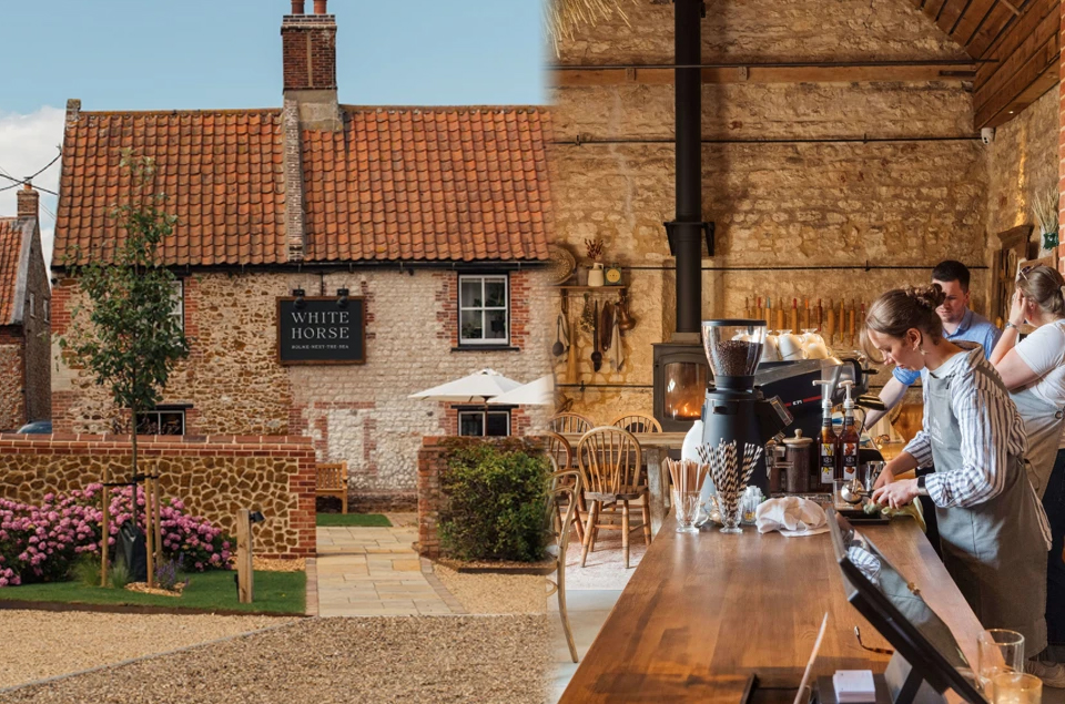
Trail terminus. Camping, campervan, motorhome, glamping. Dunes, Seahenge walk, White Horse on the doorstep.
Hunstanton / Heacham
Coast base for cliff walks, Wash sunsets, RSPB Snettisham, Wild Ken Hill. Short hop to Holme finish.
Accommodation map for walkers
Full Peddars Way stay-over planning: which base for finish, vans, dogs and rest days.


Start or finish at Holme-next-the-Sea
Stay over, make it a miniBreak. Dog-friendly bases on the North Norfolk coast, UK.
Frequently Asked Questions
How long does it take to walk the Peddars Way?
Most walkers take 4 to 5 days at 10 to 12 miles a day. Fit walkers can finish in 3. Suggested stops include Castle Acre, Sedgeford or Ringstead, and Holme-next-the-Sea.
Is the Peddars Way a Roman road?
It follows a Roman military road, likely post-Boudica (AD 60 to 61), formalising an older trackway. The straight alignment is Roman; the corridor is older.
Can you walk it with a dog?
Yes. Wide tracks, few difficult gates. Lead near livestock. Seasonal beach rules at Holme May to September on parts of the beach.
Where does it start and finish?
Start: Knettishall Heath Country Park (Suffolk border near Thetford). Finish: Holme-next-the-Sea, joining the Norfolk Coast Path.
What is special about Castle Acre?
Midpoint village on the Roman line with Norman castle earthworks and one of Norfolk’s finest priory ruins (English Heritage), plus pub and village green.
Where can I stay at Holme-next-the-Sea?
mYminiBreak Holme offers dog-friendly camping, glamping and van pitches at the trail terminus. See myminibreak.com/holme and the accommodation guide linked above.
Can you cycle the Peddars Way?
Yes on most sections. Gravel or hybrid bike recommended. Many riders complete it in about two days.
Further reading from mYminiBreak
- Birdwatching from the coast bases
- Norfolk trails hub
- Heritage destinations
- Wild Ken Hill and rewilding walks
- Peddars Way accommodation guide
The Peddars Way has carried people from the Brecks to the sea for two thousand years. It asks for boots and time. That is enough.
Stay over, make it a miniBreak.