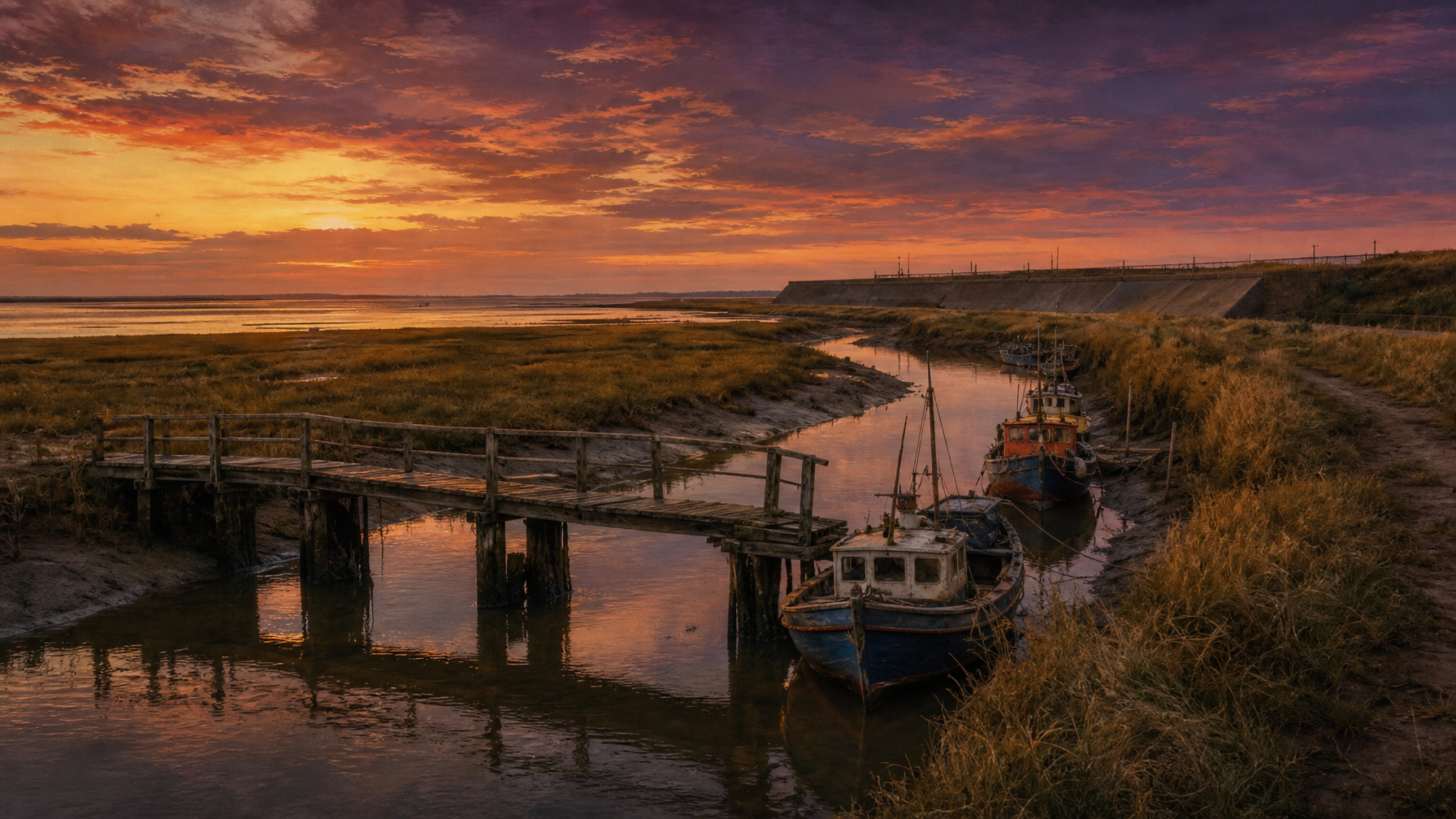
Heacham once had a working tidal creek and harbour where fishing boats moored at the outfall of the Heacham River — but Victorian sea embankments, reinforced dramatically after the catastrophic 1953 North Sea flood, sealed the creek into a landlocked pond and buried the salt marsh beneath holiday parks. The story of how a living harbour became a series of still pools is one of West Norfolk’s most atmospheric lost landscapes.
There are places in Norfolk, UK, where the land remembers water that no longer moves. You can stand on the sea wall at Heacham South Beach, look inland across a flat expanse of reeds and static pools, and know — if you know what you are looking for — that you are standing above a drowned harbour. Fishing boats once came here. Men hauled crab pots and flat-fish at the edge of The Wash. The name of the very ground beneath the mYminiBreak campsite site — Staithe Farm — is a declaration of it: in Old Norse and Old English, a staithe is a landing place, a wharf, a gathering point where fishermen meet the tide. The sea has not been to this place for decades. But the memory of it has never quite left.
The River That Reached the Sea
The Heacham River — sometimes called simply the Heacham — is a chalk stream of modest size: 16.4 kilometres from its source near Bircham Newton to its outfall on Heacham beach, discharging into The Wash. By English river standards it is barely a river at all — a chalk stream, fed by the local aquifer, running clear over gravel through meadows, past Norfolk Lavender at Caley Mill, through Heacham Park, and then turning west across low-level water meadows toward the coast.
But once upon a time, where the river reached the sea — or rather where the sea reached the river — there was something remarkable: a tidal creek. Twice daily, the tide came in across the mudflats and salt marsh, pushing up the channel, flooding the lower reaches, and giving the outfall the character of a small natural harbour. It was not a great port by any measure. But it was enough. Enough for small fishing vessels to moor. Enough for boats carrying crab pots and whelk baskets to tie up against the banks. Enough for the people of Heacham to call the farm at its edge a staithe — a landing place — and mean it literally.
The historical photographs held by Heacham Heritage include images of the Old Harbour Bridge at Heacham — a plain, functional structure over the creek, there because boats needed a channel to pass beneath and carts needed a way to cross above. That bridge is the clearest evidence that what once existed here was understood, by the people who built and used it, as a harbour. You do not build a harbour bridge over a drainage ditch.
The Salt Marsh and the People Who Worked It
Before the embankments came, the landscape behind Heacham beach was a living salt marsh — the kind of tidal ecosystem that is now one of the rarest and most ecologically precious habitats in Britain. Salt marsh is not empty land. It is extraordinarily productive: a nursery for fish and crustacea, a feeding ground for wading birds, a filter between land and sea. The people of this coast had worked it for centuries, harvesting samphire — a tradition that continues at Holme and Wells today — cutting sea grass, grazing hardy breeds of sheep and cattle on the higher reaches.
The creek was the artery of this economy. At low tide, the mudflats were exposed and accessible. At high tide, the water came in, and boats could float. The rhythm of the tides was not a hazard to be managed but a resource to be used. The place was alive in a way that the flat, fenced-off expanse of holiday park land that now occupies the same ground is not — or not in the same way.
Faden’s map of Norfolk — produced at the end of the eighteenth century and one of the most detailed surveys of the county ever made — clearly marks the sea wall linking Heacham and Snettisham as a significant feature. This tells us that embankment building on this section of the West Norfolk coast is considerably older than the Victorian era. The impulse to push the sea back, to claim the salt marsh for agriculture, is as old as the settlement of this coast itself. But the most transformative period came in the later nineteenth and early twentieth centuries, when improvements in engineering and a growing demand for arable land drove a systematic programme of reclamation across the southern and western shores of The Wash. Between approximately 1890 and 1940, the embankments along this coast were raised, extended and consolidated into the near-continuous sea wall that still runs southward from Hunstanton today.
What the Embankment Did to the Harbour
The logic of an embankment is simple: you build a wall between the land and the sea, and the sea stops coming in. What that means for a tidal creek — a channel that depended entirely on the twice-daily exchange of salt water — is equally straightforward, and equally irreversible. When the embankment closed the outfall of the Heacham River, the creek did not drain away. It became a pond. The tidal channel that had once carried fishing boats on the flood tide became a series of still pools running parallel to the coast, cut off from the sea by the new wall, collecting the outflow of the river and going nowhere until the tidal flaps opened at low tide to let the freshwater drain.
The boats that had worked the creek could no longer move in and out with the tide. In the years that followed, some were left where they sat. Gradually, imaginatively, and perhaps with a Norfolk pragmatism that should be admired, some of these stranded boats became homes — floating in the still creek water, repurposed as holiday accommodation. It was a natural progression. The salt marsh behind the wall was already being occupied by the precursors of the modern holiday park: simple bungalows, then caravans, taking advantage of a strip of coast that, with the sea now safely behind the embankment, felt manageable, even safe. The old boats became caravans became static homes. The harbour became a leisure amenity. The salt marsh became South Beach holiday park.
There is something quietly melancholy about this process, but also something very Norfolk about it. This county has always had a way of absorbing its lost things — its lost villages consumed by the sea at Happisburgh, its lost port at Blakeney, its lost Bronze Age temple at Holme — and turning them into the particular texture of a place that feels older and stranger than it first appears. The creek at Heacham is not gone. It is just very still.
Stay Where the Fishermen Once Gathered
mYminiBreak’s Hunstanton and Heacham site sits on the ground of Staithe Farm — the original landing place. Dogs welcome. The coast path starts at your pitch.
The Night the Sea Came Back
On the evening of 31 January 1953, a catastrophic combination of a severe northerly gale and an exceptionally low barometric pressure system drove a storm surge southward down the North Sea. The surge peaked on the night of 31 January into the early hours of 1 February — and what it did to the low-lying coast of West Norfolk was, by any measure, the worst coastal flood disaster in UK recorded history.
Between Heacham and Downham Market alone, more than 4,000 hectares of land were inundated. The figure comes from the scientific record: Grove’s 1953 report, published in the immediate aftermath, documented the scale of the flood with a precision that only makes it more harrowing to read. Four thousand hectares. Land that had been farmed and lived on and trusted, because the embankment was there, because the wall between the sea and the fields was solid and tall, because the engineers had done their work — all of it underwater in a matter of hours.
The sea wall at Heacham South Beach was breached. The water that the embankment had been built to exclude came pouring back in — not through the sealed creek, but over and through the defences themselves, across the same ground that had been reclaimed from the marsh over the preceding decades. The Guardian’s archives preserve the images: women searching through the debris of houseboats in Heacham in the days after the surge, trying to salvage what was left of homes that had sat, apparently safely, beside the still water of the blocked-off creek.
The mYminiBreak site at South Beach occupies ground that sits naturally some two metres above the surrounding low-lying land. This elevation — a modest ridge in a famously flat county — meant the site was largely unaffected by the 1953 floods, even as the land around it went under. Two metres is not a great height. But in this landscape, it was the difference between dry ground and catastrophe.
In the aftermath of the disaster, the sea walls and embankments along this coast were dramatically reinforced. The concrete sea wall at Heacham South Beach — the structure that still holds the sea back today — was substantially rebuilt and raised to a new standard. The lesson of 1953 was written into the landscape in concrete, and the creek that had once been a harbour receded further into history, its margins now defined not by a Victorian earth embankment but by a modern engineered flood defence.
For those who want to understand the full geography of the 1953 surge — and what it means for the coast you are standing on today — the Historic England coastal mapping programme has documented the archaeology and flood history of the Norfolk coastal zone in extraordinary detail. And the mYminiBreak history page at norfolkcoast-cottage.co.uk/about-us/history-of-south-beach holds historic aerial photographs from 1953 that show the actual extent of flooding around the site — one of the most visceral ways to understand just how close the water came.
Staithe Farm: The Name That Remembers
Of all the evidence for Heacham’s maritime past, the most quietly powerful is the name of the farm that once occupied the ground of the mYminiBreak site. Staithe Farm. A staithe — from the Old Norse stöð and the Old English equivalent — means a landing place, a wharf, a place where boats come ashore and goods are loaded or unloaded. It is a word with strong Viking resonance on this coast, which was deeply shaped by Scandinavian settlement during the Danelaw period after 865 AD. (Heacham itself, like so many West Norfolk place names ending in -ham, carries the mark of that same settlement.)
The name Staithe Farm is not a poetic invention. It is a practical description. At some point in the past — we cannot say exactly when, but the name was established long before any Victorian map-maker arrived — the farm at this location was understood as a place where people gathered at the water’s edge. Where boats arrived. Where the land and the tidal creek met in a way that was useful to human beings. The name has outlasted the creek it described. It has outlasted the boats that used it. It endures in the historical record as a small, precise testament to the working harbour that once existed here and is now, in the most literal sense, landlocked.
What You Can See Today
If you stay at mYminiBreak’s Hunstanton and Heacham site and walk south along the coast path toward Snettisham, you will cross the sea embankment and look back at the pools that the blocked-off creek has become. The reed beds. The still water. The wildfowl that now use the isolated pools as a wetland habitat — an unintended ecological reward for a landscape altered by engineering. The concrete wall to your west. The Wash opening up to the north, vast and shining at low tide.
The historical photographs of the Old Harbour Bridge at Heacham are held by Heacham Heritage, whose community archive is one of the most detailed records of life on this stretch of coast. If you are interested in the visual history of what the creek and its surroundings looked like before the embankment changed everything, their photograph collection is the place to start.
The Heacham River still runs. It still rises near Bircham Newton, still passes beneath Peddars Way at Fring, still flows past Norfolk Lavender at Caley Mill, still crosses under the A149 and skirts around the northern edge of Heacham village. It still ends up against the tidal flaps at South Beach, filling its series of pools that run parallel to the coast. At low tide, those flaps open, and the water drains. The river still meets the sea. It just does so, now, through a sluice gate in a concrete wall, rather than through the open mouth of a living tidal harbour. A detail, perhaps. But the kind of detail that changes a landscape entirely.
🛖 Hunstanton Glamping
Shepherd huts, bell tents and camping pitches on the ground of Staithe Farm — raised above the flood plain, looking out over the coast. Dogs welcome.
🏡 Norfolk Coastal Cottages
Self-catering holiday cottages near Hunstanton, just minutes from the beach and the coast path south toward Snettisham. Dogs welcome.
Frequently Asked Questions
Did Heacham really have a harbour?
Yes — Heacham had a working tidal creek and harbour at the outfall of the Heacham River, where small fishing boats moored at high tide. The Old Harbour Bridge crossed the creek, and historical photographs of it survive in the Heacham Heritage archive at heachamheritage.co.uk. The name Staithe Farm — which means a landing place — confirms the maritime character of the site long before modern maps recorded it.
What happened to the Heacham creek?
Sea embankments built between approximately 1890 and 1940 along the West Norfolk coast sealed the tidal outfall of the Heacham River, turning the tidal creek into a landlocked series of pools. The channel no longer received the tide, boats could not navigate it, and the surrounding salt marsh was progressively converted to agricultural and then holiday park use. The river still runs to the coast but now drains through tidal flaps in the concrete sea wall rather than through an open tidal channel.
How bad was the 1953 flood at Heacham?
The 1953 North Sea storm surge was the worst coastal flood disaster in UK recorded history. At Heacham, the concrete sea wall at South Beach was breached and the surrounding low-lying land was inundated. Scientific records document that over 4,000 hectares were flooded between Heacham and Downham Market. The mYminiBreak site, sitting naturally around two metres above the surrounding land, was largely unaffected. Historic aerial photographs of the 1953 floods can be seen at norfolkcoast-cottage.co.uk/about-us/history-of-south-beach.
What does “Staithe Farm” mean?
Staithe is an Old Norse and Old English word meaning a landing place or wharf — a point at the water’s edge where boats arrived and goods were loaded and unloaded. The name of Staithe Farm, which occupied the ground of the current mYminiBreak Hunstanton and Heacham site, confirms that the site was historically associated with maritime activity at the tidal creek. The word carries Viking heritage consistent with the Scandinavian settlement of West Norfolk during the Danelaw period.
Where can I find historical photographs of the Heacham harbour and creek?
Heacham Heritage (heachamheritage.co.uk) holds a community photographic archive including images of the Old Harbour Bridge at Heacham. Historic aerial photographs of the area taken in 1953 — including images showing the extent of flooding — can be viewed on the mYminiBreak history page at norfolkcoast-cottage.co.uk/about-us/history-of-south-beach.
Can I walk the coast path near the old creek from the mYminiBreak site?
Yes. Guests staying at mYminiBreak’s Hunstanton and Heacham site can walk directly onto the King Charles III England Coast Path, which runs along the top of the sea embankment. Walking south toward Snettisham takes you past the pools and reed beds that occupy the old creek channel — a quiet, evocative walk through a landscape shaped by centuries of human intervention in the tidal edge. You can book your stay at norfolkcoast-cottage.co.uk/camping/hunstanton.
Leave a Reply